Maps
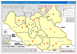
Map of reported conflict incidents in Southern Sudan (1 - 30 October 2010)
Southern Sudan: Reported conflict incidents 1 - 30 October 2010: 5 Incidents, UN Office for the Coordination of Humanitarian Affairs (UN OCHA) (October 2010) (Map or infographic, English)
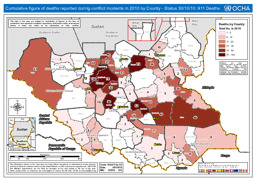
Map on deaths reported during conflict incidents in Southern Sudan in 2010 shown by county, as of 30 October 2010
Southern Sudan: Cumulative figure of deaths reported during conflict incidents in 2010 by County, UN Office for the Coordination of Humanitarian Affairs (UN OCHA) (October 2010) (Map or infographic, English)

Political map (June 2010)
Uganda and Surrounding Countries (Details) - As of Jun 2010 (Map or infographic, English)
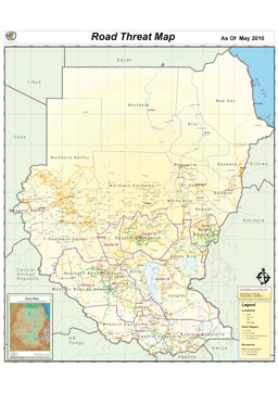
General threat map (May 2010)
General Threat Map - As of May 2010 (Map or infographic, English)

Situation map on humanitarian assistance by USAID (as of 3 May 2010)
USG Humanitarian Assistance to East and Central Africa (Map or infographic, English)
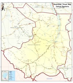
Central Equatoria State: Road and landmine threat map
Road & Landmine / ERW Threat Map - Central Equatoria (Map or infographic, English)
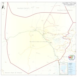
North Bahr El Ghazal: Road and landmine threat map
Road & Landmine / ERW Threat Map - North Bahr El Ghazal (Map or infographic, English)

Unity State: Road and landmine threat map
Road & Landmine / ERW Threat Map - Unity State (Map or infographic, English)
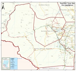
West Bahr El Ghazal: Road and landmine threat map
Road & Landmine / ERW Threat Map - West Bahr El Ghazal (Map or infographic, English)
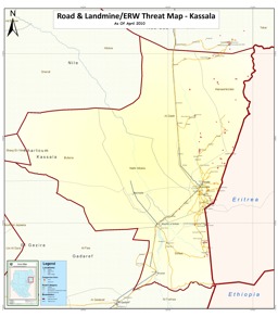
Kassala State: Road and landmine threat map
Road & Landmine / ERW Threat Map - Kassala (Map or infographic, English)


Documents found: 546
