Landkarten
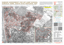
Landkarte zum Binnenvertriebenenlager Kasasa, Stadt Kiwanja, Provinz Nord-Kivu; Stand November 2008
Damage Assessment for IDP Camp Kasasa, Kiwanja Town, North Kivu Province, United Nations Operational Satelite Applications Programme (UNOSAT) (November 2008) (Landkarte oder Infografik, Englisch)
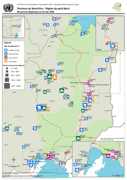
Nordkivu: Landkarte zu Vertriebenen (Stand 22. Mai 2008)
Province du Nord-Kivu - Personnes déplacées au 22 mai 2008 (Landkarte oder Infografik, Englisch)
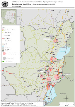
Nordkivu: Landkarte mit wahrscheinlich von Rückkehr von Binnenflüchtlingen betroffenen Gebieten (Februar 2008)
Province du Nord Kivu - Zones de retour probable (Février 2008) (Landkarte oder Infografik, Englisch)
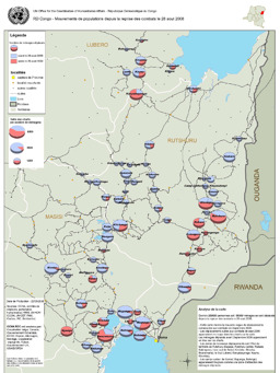
Karte von Bevölkerungsströmen seit Beginn der Kämpfe im August 2008
Mouvements de populations depuis la reprise des combats le 28 août 2008 (Landkarte oder Infografik, Französisch)
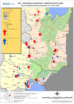
Nord Kivu: Gebiete Binnenvertriebener (Jänner 2008)
Province du Nord Kivu - Région du Petit Nord - Zones de déplacement des populations, (January 2008) (Landkarte oder Infografik, Englisch)

Karte zur Verteilung von kongolesischen Flüchtlingen auf Nachbarländer
DR Congolese Refugee Population (as of 3 Oct 2007) (Landkarte oder Infografik, Englisch)
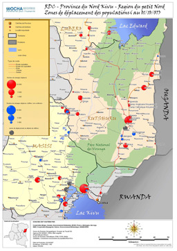
Nordkivu: Landkarte von Gebieten mit Vertreibungen (Stand 1. Oktober 2007)
Province North Kivu - Zones of displacements (as of 1 October 2007) (Landkarte oder Infografik, Englisch)
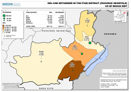
Bezirk Ituri: Landkarte zu Binnenvertriebenen und Zurückkehrenden (März 2007)
Democratic Republic of the Congo: IDPs and Returnees in the Ituri District - Province Orientale (as of March 2007) (Landkarte oder Infografik, Englisch)
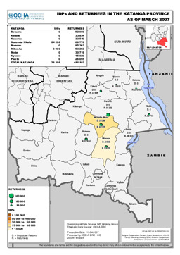
Provinz Katanga: Landkarte zu Binnenvertriebenen und Zurückkehrenden (März 2007)
Democratic Republic of the Congo: IDPs and Returnees in the Katanga Province (as of March 2007) (Landkarte oder Infografik, Englisch)
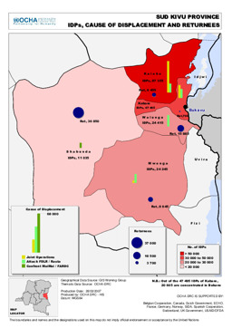
Provinz Sud Kivu: Landkarte zu Binnenvertriebenen, Grund der Vertreibung und Zurückkehrenden (März 2007)
Democratic Republic of the Congo: Sud Kivu Province - IDPs, Cause of Displacement and Returnees (as of March 2007) (Landkarte oder Infografik, Englisch)

Gefundene Dokumente: 403
